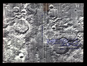
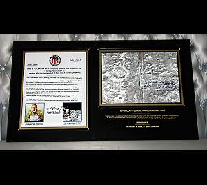
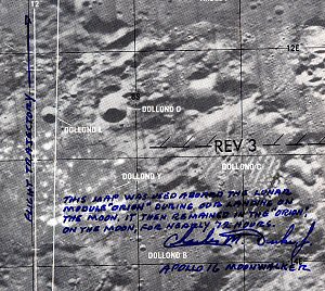
A map that helped guide some of the first humans to landfall on the Moon!
Each of the six Apollo lunar-landings teams were supplied with a
"Lunar Orbit Monitor Chart", to use in the Lunar Module.
This chart consisted of a long paper strip-map composed of 24 individual plates.
Each of the plates, in turn, depicts approximately 5500 square miles of the lunar surface.
They were used by the astronauts to help navigate in the Lunar Module,
while preparing to descend to the Moon! This specific map, measuring some
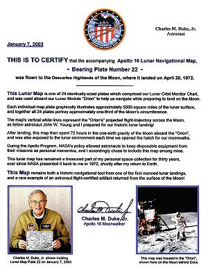
8 x 10 inches, is "Plate 22" from the Apollo 16 Lunar Orbit Monitor Chart.
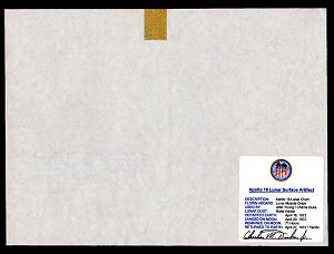
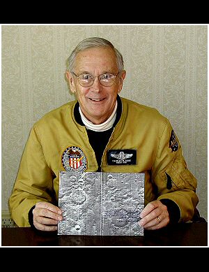
The map has been properly flight-certified by Charles M. Duke, Jr., from whose
collection it originates. Also accompanied by Duke's flight-certification certificate,
and archivally-housed in a Peachstate display case.
One of the most symbolically important, historic, and traveled maps
in the history of human exploration!